.
Here is a link to the interactive expedition map.
This is part of the trail from the Point Royal parking lot south to the rim of the canyon. It's paved. And there is lots of signage describing the plants.
There are many places along the trail where you can see a long, long way over (and down into) the canyon.
That black spot in the upper right corner is a bird. There are three condors who live somewhere along here. On May 30, when my husband and daughter were walking part of this section of Grand Canyon national park, my husband thinks he may have seen the condors. He saw three really big birds........ Maybe the condors. When I zoom way in, I can sort of make out body and wings on this black spot. The wings are short enough that I do not think it's a condor. But isn't it cool that he may have seen condors???
Looking down into the canyon. We definitely saw water at the bottom in some places along this part of the plateau. I'm not sure if that beige line in the upper left corner was wet, or was just a place that would be wet, if there were enough running water. (Note pale thin jaggedy rock formation in upper right -- we'll see that in the next two images as well.)
Tip the camera up and a bit to the right of the previous image, and you get this next image. (Note big rock formation at the top -- it will feature in the next image.)
The next image is straight up from the previous one (just a tiny bit of the tip of the jaggedy bit at the bottom, but you can really see the big green-topped formation).
It looks like it's raining out there.....
We can definitely see water in this image, pretty much in the center of the image. It's blue....
A better look at the water. As when I'm on an airplane, when I try to correct for haze the color starts to get wonky......
There was active weather south of our location. It was dark. We heard thunder. When we got down to the end of the trail, we could see lightning. This did not seem good, so we retreated.........
To the east, all seemed to be well. And to the north, things were more promising than to the south. This is looking southeast, I think.
I did not want to hustle back to the car. I wanted to read the signs and take pics of the plants.
I wonder how long these signs survive. This one is still legible. Mostly.
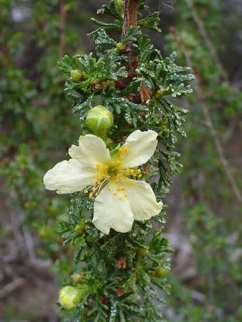
I think this is cliffrose. The leaves look rather coniferous, but I don't think this is a conifer.
Here's this nice yellow stuff we've seen here and there in the national parks.
Pretty sure this is a different sort of pine? than we saw in the previous post. The needles are shorter, and the "new growth" thingie is totally different.
The next image is a grown tree of the kind in the closeup above. (Maybe the same tree; I can't remember.)
Water.........
Looking south. This was a really big cloud. Probably the biggest one I've ever seen. This next image is two pics stitched together; I couldn't fit even this part of the cloud into one pic.
Tipping the camera down from taking the above two images (now combined into one). The look-out area at the end of the trail is visible at right (you can see one of the information boards on top of the rocks). At least, I think that's which look-out area we can see here.
That's a big bend of river, just under the dark purple cliffs in the top center of this next image.
This is a zoomed in image. Haze = wonky color, when I try to sharpen things up. I'm sure it wasn't/isn't all purple/blue like this.
The next pic is just to the left of the wide view of the river, etc., that we saw a few images ago.
This is the other end of that huge cloud. We're back in the Point Royal parking lot, getting ready to head north away from the storm.
I'm sorry I didn't get to dawdle here, and read all the signage, and take even more pics. Ah well.
Here is a link to the next post about the Grand Canyon trip.
.
Subscribe to:
Post Comments (Atom)


No comments:
Post a Comment